Blog

  • حي الرفيعة الرياض: حدوده وخدماته وأسعار العقارات فيه

    حي الرفيعة الرياض: حدوده وخدماته وأسعار العقارات فيه

    التعريف بحي الرفيعة وموقعه داخل الرياض

    يسأل الباحثون عن حي الرفيعة الرياض اين يقع أكثر مما يسألون عن أي تفصيل آخر فيه، وهو سؤال وجيه لأن الحي أقل شهرة من الأحياء الكبرى في العاصمة رغم أنه يقدّم ما يبحث عنه كثيرون: طابع سكني هادئ وأسعار متوازنة. وحي الرفيعه الرياض حي سكني الطابع تتوزع فيه الفلل والعمائر ضمن نسيج منظم نسبياً. وتتناوله إنسبكتكس بالتفصيل الذي يحتاجه المشتري، مع التركيز على ما يغيّر قرار الشراء أو سعره فعلاً.

    هل حي الرفيعة شمال الرياض؟ تحديد النطاق

    يميل موقع الحي إلى النطاق الذي يصعب وصفه بالشمال الخالص أو الوسط الخالص، وهو ما يسبب الالتباس المتكرر عند السؤال عنه. والأدق للمشتري أن يحدد موقع العقار المستهدف على الخريطة وبالنسبة إلى مقر عمله، لا أن يعتمد على التصنيف الجغرافي العام، لأن هذا التصنيف لا يعني شيئاً عملياً في زمن الرحلة اليومية.

    الأحياء المجاورة والطرق الرئيسية

    تحدّ حي الرفيعة في الرياض مجموعة من الأحياء التي تشترك معه في الطابع السكني وتتفاوت عنه في مستوى الأسعار والخدمات، ويتصل بعدد من المحاور الرئيسية التي تربطه ببقية أجزاء العاصمة. ويختلف التقسيم الدقيق لحدوده بحسب ما تعتمده أمانة منطقة الرياض.

    الطابع العمراني وتوزيع الاستخدامات في الحي

    يغلب على الحي الطابع السكني مع نطاقات تجارية محدودة على الشوارع الرئيسية، وهو توزيع يمنح الشوارع الداخلية هدوءاً نسبياً. وتتفاوت أعمار المباني فيه بين حديثة التنفيذ وأخرى أقدم، كما يتفاوت مستوى التنفيذ بين منفّذ وآخر. وتبقى اشتراطات الأمانة من عدد الأدوار ونسب البناء والارتدادات هي المرجع لأي أعمال بناء أو توسعة.

    عقارات حي الرفيعة وأنواعها

    يوفر الحي خيارات متعددة تخدم الأسر والمستثمرين.

    الفلل والأدوار

    تمثل الفلل والأدوار الخيار الأبرز للأسر الباحثة عن استقلالية ومساحة، وتتنوع بين نماذج حديثة وأخرى أقدم بمستويات تشطيب متفاوتة.

    الشقق والعمائر

    تتوفر شقق ضمن عمائر سكنية تناسب الأسر الصغيرة والمستثمرين الباحثين عن عائد إيجاري، بأسعار أقل من الفلل.

    الأراضي السكنية

    تمثل الأراضي فرصة لمن يفضّل البناء وفق تصميمه الخاص، وتتفاوت قيمتها بحسب موقع القطعة وعدد واجهاتها ومدى اكتمال الخدمات في نطاقها.

    أسعار العقارات وسعر المتر في الرفيعة

    ينتمي الحي إلى النطاق المتوسط في سوق الرياض، وهو ما يجعله خياراً عملياً لشريحة واسعة. ويتحدد سعر المتر فيه بعوامل أبرزها موقع العقار داخل الحي وقربه من المحاور الرئيسية، والمساحة وعدد الواجهات، وعمر المبنى ومستوى تشطيبه وحالته الإنشائية. ويُنصح بمقارنة أكثر من عرض عقاري موثوق لتحديد السعر العادل، مع احتساب ضريبة التصرفات العقارية والتكاليف النظامية ضمن الميزانية الكلية للصفقة قبل إتمامها لا بعدها.

    الخدمات التعليمية في الحي ومحيطه

    تتوفر في الحي ومحيطه مدارس حكومية وأهلية وحضانات تخدم مختلف المراحل، مع قرب من مؤسسات تعليمية أكبر في الأحياء المجاورة. وتتوسع هذه الخدمات تدريجياً مع نمو عدد السكان في النطاق.

    الخدمات الصحية والصيدليات

    يخدم الحي عدد من المراكز الصحية والعيادات والصيدليات الموزعة داخله وعلى محاوره، مع قرب من مستشفيات ومجمعات طبية أكبر تغطي التخصصات المختلفة.

    المساجد والأسواق والحدائق والمرافق الرياضية

    تنتشر المساجد في أنحاء الحي بما يناسب توزيع سكانه، وتتوفر أسواق ومتاجر ومحلات خدمات يومية على الشوارع الرئيسية. كما تتضمن مخططاته مساحات للحدائق والمرافق الرياضية يتفاوت مستوى تجهيزها بين نطاق وآخر، وهو ما يُنصح بمعاينته ميدانياً في المحيط المباشر للعقار المستهدف.

    المواصلات والوصول إلى الحي

    يعتمد التنقل في الحي على السيارة الخاصة بصورة أساسية، مع توفر خيارات النقل التشاركي وخطوط النقل العام التي تخدم النطاق. ويُنصح بتجربة مسار الرحلة اليومية إلى مقر العمل في وقت الذروة قبل حسم قرار السكن، فهي المعلومة الأكثر تأثيراً في جودة الحياة اليومية.

    البنية التحتية وأعمال التطوير

    تتوفر في معظم نطاقات الحي شبكات الكهرباء والمياه والصرف الصحي والسفلتة والإنارة، وتتواصل أعمال التطوير لتحسين الطرق والخدمات. ويتفاوت مستوى اكتمال هذه الأعمال بين مخطط وآخر داخل الحي، كما تستحق كفاءة تصريف مياه الأمطار معاينة في بعض الشوارع لارتباطها بمشكلات الرطوبة في الأدوار الأرضية.

    الفحص الهندسي قبل الشراء في الرفيعة مع إنسبكتكس

    يقدّم إنسبكتكس فحصاً هندسياً شاملاً يغطي أنظمة المبنى كاملة، بفريق ثلاثي من المهندس المدني والكهربائي والميكانيكي. والهدف ليس إحصاء العيوب بل تمكين المشتري من تسعير الصفقة بواقعية ومعرفة ما ينتظره من تكاليف.

    بنود التقرير: الإنشائي والأساسات والعزل والسباكة والكهرباء والتكييف والتشطيبات

    يغطي التقرير الأعمال الإنشائية من أساسات وأعمدة وجسور وأسقف وأرضيات وعناصر حاملة مع تمييز التشققات السطحية من الإنشائية والتحقق من مطابقة المبنى لكود البناء السعودي SBC؛ والعزل المائي للأسطح والحمامات والعزل الحراري للواجهات؛ وشبكات السباكة والصرف مع اختبار التسربات وقياس ضغط المياه؛ والأعمال الكهربائية من لوحات توزيع وتمديدات وأنظمة حماية وتأريض؛ وأنظمة التكييف وكفاءة توزيعها؛ والتشطيبات من دهانات وأرضيات وسيراميك وأبواب ونوافذ ونجارة وجبس. وتستحق الواجهات انتباهاً خاصاً في المباني ذات التكسيات الحجرية، إذ يمثل تساقط حجر الواجهات خطراً مباشراً ومسؤولية على المالك.

    الفحص غير الإتلافي للعناصر المغطاة

    تُستخدم تقنيات الفحص غير الإتلافي لتقييم العناصر المغطاة والخفية — كالخرسانة والتسليح وشبكات الخدمات المدفونة — دون الحاجة إلى أي تكسير. وهذا ما يسمح بالحكم على حالة المبنى الحقيقية دون إحداث ضرر في العقار ودون تكاليف استكشافية إضافية.

    ما الذي يغير قرار الشراء أو سعره

    ليست كل ملاحظة سبباً للتراجع عن الصفقة. ويفصل التقرير بين ثلاث فئات: ملاحظات تمسّ السلامة الإنشائية وتستدعي إعادة النظر في الشراء أو تخفيضاً جوهرياً في السعر؛ وملاحظات في الأنظمة كالسباكة والكهرباء والتكييف تُقدَّر تكلفتها وتُخصم من السعر أو يُلزم البائع بمعالجتها؛ وملاحظات تجميلية في التشطيبات لا تستحق تعطيل الصفقة. وهذا التصنيف هو ما يحوّل التقرير إلى أداة تفاوض بيد المشتري. ومن الحكمة إجراء فحص فلل قبل الشراء قبل التوقيع، مع ملاحظة أن مؤشرات بسيطة كـأسباب تقشر الدهان قد تكشف رطوبة خلف الجدار لا عيباً في الطلاء.

    أسئلة متكررة عن حي الرفيعة الرياض

    أين يقع حي الرفيعة في الرياض؟

    يقع ضمن النطاق السكني للعاصمة متصلاً بمحاور رئيسية تربطه ببقية أجزاء المدينة، وتحدّه أحياء تشترك معه في الطابع السكني الهادئ.

    هل حي الرفيعة شمال الرياض؟

    يميل موقعه إلى نطاق بيني يصعب وصفه بالشمال الخالص، ولهذا يتكرر الالتباس عند السؤال عنه. والأدق تحديد موقع العقار على الخريطة وبالنسبة إلى مقر العمل.

    ما أنواع العقارات في الحي؟

    تشمل الفلل والأدوار، والشقق السكنية ضمن العمائر، والأراضي السكنية.

    كم سعر المتر في حي الرفيعة؟

    ينتمي إلى النطاق المتوسط في سوق الرياض، ويتفاوت بحسب موقع العقار داخل الحي ومساحته وعدد واجهاته وعمر المبنى وحالته. ويُنصح بمراجعة أحدث العروض الموثوقة لتحديد السعر العادل.

    اجعل التقرير الهندسي هو ما يحدد سعرك العادل في الرفيعة

    يقدّم حي الرفيعة الرياض توازناً جيداً بين الهدوء السكني والأسعار المعقولة، لكن تفاوت أعمار المباني ومستويات تنفيذها يعني أن السعر المعلن لا يعكس القيمة الحقيقية دائماً. يمنحك فريق إنسبكتكس تقريراً هندسياً معتمداً يغطي أنظمة العقار كاملة ويفصل بين ما يستدعي إعادة النظر وما يُخصم من السعر وما يمكن تجاهله. ابدأ الآن عبر طلب الخدمة من إنسبكتكس.


  • حي الخير الرياض: مخططاته شمال غرب العاصمة وأسعار أراضيه

    حي الخير الرياض: مخططاته شمال غرب العاصمة وأسعار أراضيه

    اين يقع حي الخير في الرياض

    يختلف حي الخير الرياض عن معظم ما سبق تناوله من أحياء العاصمة في نقطة جوهرية: جزء كبير منه ما زال أرضاً بيضاء تنتظر البناء. فالحي يقع في النطاق الشمالي الغربي من الرياض ضمن مناطق التوسع العمراني، وهو ما يجعله سوقاً للأراضي أكثر منه سوقاً للمباني الجاهزة. ولهذا السبب يختلف ما يحتاجه المشتري هنا عن غيره: فهو يشتري أرضاً ليبني عليها، لا مبنى ليفحصه. وتتناول إنسبكتكس الحي من هذه الزاوية تحديداً، لأن قرارات ما قبل البناء هي الأكثر تأثيراً في التكلفة النهائية.

    الحدود والأحياء المجاورة

    تحدّ الرياض حي الخير مجموعة من المخططات والأحياء في النطاق الشمالي الغربي، ويختلف التقسيم الدقيق لحدوده بحسب ما تعتمده أمانة منطقة الرياض. ويجاوره عدد من المخططات التي تشترك معه في مرحلة التطوير وتتفاوت عنه في جاهزية الخدمات.

    الطرق والمخارج والمسافة إلى وسط الرياض

    يتصل الحي بمحاور رئيسية تربط شمال غرب العاصمة ببقية أجزائها، ويخدمه أكثر من مخرج. وتطول المسافة إلى وسط الرياض وإلى مراكز الأعمال مقارنة بالأحياء الوسطى والشمالية المكتملة، وهو ما يفسّر جزءاً من الفارق السعري. ويُنصح بقياس زمن الرحلة من موقع القطعة تحديداً في وقت الذروة قبل الشراء.

    مخططات الخير في الرياض وتقسيماتها

    يقوم الحي على عدد من المخططات المعتمدة التي تختلف اختلافاً ملموساً في مستوى جاهزيتها.

    المخططات المعتمدة وحالة الخدمات فيها

    تتفاوت المخططات داخل الحي بين ما وصلت إليه الخدمات من كهرباء ومياه وصرف وسفلتة وإنارة، وما لا يزال في انتظارها. وهذا التفاوت هو العامل الأهم في تفسير فروق الأسعار داخل الحي الواحد، وهو أيضاً أكثر ما يُغفل عند الشراء. فالقطعة الأرخص قد تكون في مخطط تحتاج فيه إلى انتظار سنوات قبل أن تتمكن من البناء والسكن فعلاً، وهي تكلفة زمنية ومالية حقيقية. لذلك فإن السؤال الصحيح قبل الشراء ليس «كم سعر المتر؟» بل «ما حالة الخدمات في هذا المخطط تحديداً؟».

    الاستخدامات السكنية والتجارية

    توزّع المخططات الاستخدامات بين السكني والتجاري، وتحدد اشتراطات البناء من عدد الأدوار ونسب البناء والارتدادات النظامية. ويجب على المشتري التحقق من الاستخدام المصرح به للقطعة ومن اشتراطاتها قبل الشراء، لأنها تحدد ما يمكن تنفيذه فعلاً على الأرض.

    كم سعر أراضي مخطط الخير

    تمثل أسعار الأراضي محور الاهتمام الأول في هذا الحي.

    متوسط سعر المتر بحسب الموقع داخل المخطط

    يتفاوت سعر المتر تفاوتاً واضحاً بحسب المخطط ومدى اكتمال خدماته، وموقع القطعة وعدد واجهاتها، وقربها من المحاور الرئيسية. ويميل عموماً إلى النطاق المناسب مقارنة بالأحياء الشمالية المكتملة، وهو ما يجعل الحي مقصداً للمستثمرين على المدى المتوسط وللباحثين عن أرض لبناء مسكنهم. ومن المهم أن يعلم مالك الأرض أن الاحتفاظ بها دون تطوير قد يرتب التزامات مالية، إذ تنطبق على بعض الأراضي الفضاء ضوابط رسوم الأراضي البيضاء بحسب الموقع والمساحة، وهو عامل يجب احتسابه في أي قرار استثماري طويل الأمد.

    أسعار الفلل والوحدات السكنية

    تتوفر في النطاقات المبنية من الحي فلل ووحدات سكنية حديثة التنفيذ، وتتفاوت أسعارها بحسب المساحة ومستوى التشطيب وجاهزية الخدمات في النطاق المحيط.

    الإيجارات السنوية

    تميل الإيجارات في الحي إلى مستوى مناسب، وهي محدودة نسبياً بحكم أن السكن فيه لا يزال في طور النمو وأن كثيراً من وحداته حديثة أو تحت الإنشاء.

    البنية التحتية وجاهزية الخدمات في الحي

    تشهد المنطقة أعمال تطوير مستمرة لتوصيل الخدمات وتنفيذ الطرق والسفلتة والإنارة، وتتقدم هذه الأعمال بوتيرة متفاوتة بين مخطط وآخر. ويبقى الفارق بين المخطط المخدوم وغير المخدوم هو أهم تمييز في هذا الحي، ويُنصح بالتحقق منه بمعاينة ميدانية وبالاستفسار الرسمي عن حالة التوصيل، لا بالاعتماد على الوعود التسويقية.

    الخدمات التعليمية والصحية والمساجد

    تتوفر في النطاقات المأهولة من الحي ومحيطه مدارس ومراكز صحية وصيدليات ومساجد، وتتوسع هذه الخدمات تدريجياً مع نمو عدد السكان. ويبقى مستواها أقل كثافة من الأحياء المكتملة، وهو أمر متوقع في مناطق التوسع الجديدة ويستحق أن يُحتسب عند تقييم جودة الحياة اليومية.

    الأسواق والمرافق التجارية والحدائق

    تنتشر على محاور الحي محلات ومتاجر ومرافق تجارية تخدم الاحتياجات اليومية، إلى جانب مساحات مخصصة للحدائق ضمن المخططات يتفاوت مستوى تجهيزها بحسب مرحلة التطوير.

    المواصلات والوصول إلى حي الخير

    يعتمد التنقل على السيارة الخاصة بصورة أساسية، مع خيارات النقل التشاركي. ويستفيد الحي من اتصاله بالمحاور الكبرى في شمال غرب العاصمة، مع الأخذ في الحسبان أن المسافة إلى وسط المدينة ومراكز الأعمال أطول من الأحياء الأقرب للمركز.

    ما يُفحص قبل شراء أرض أو البناء في مخططات الخير

    الفحص في مرحلة ما قبل البناء يختلف جوهرياً عن فحص المباني القائمة، وقيمته أعلى لأن تصحيح الخطأ لاحقاً أصعب وأكلف بكثير.

    فحص التربة والجسات قبل التصميم

    تحدد خصائص التربة نوع الأساسات المناسب وأبعادها، ويُجرى ذلك عبر جسات واختبارات تكشف طبقات التربة وقدرتها على التحمل ومنسوب المياه الجوفية إن وُجد. وإجراء هذه الدراسة قبل التصميم يوفّر على المالك تكاليف كبيرة ويمنع مشكلات إنشائية لا تظهر إلا بعد سنوات من البناء، مثل الهبوط غير المنتظم والتشققات.

    مطابقة الصك والحدود والاشتراطات

    يشمل التحقق من مطابقة حدود الأرض ومساحتها لبيانات الصك، والتأكد من سلامة وضعها النظامي وخلوها من أي تداخل، ومن اشتراطات البناء المصرح بها. ويُعد نظام التسجيل العيني للعقار مرجعاً أساسياً في هذا الجانب قبل إتمام الصفقة.

    مرافقة إنسبكتكس لمراحل البناء في حي الخير حتى الاستلام

    لا تنتهي مهمة الفحص عند الأرض، فمتابعة التنفيذ مرحلةً بمرحلة هي ما يضمن أن ما نُفّذ يطابق ما صُمّم. ويعتمد ذلك على فريق ثلاثي من المهندس المدني والكهربائي والميكانيكي، مع تقنيات الفحص غير الإتلافي لتقييم العناصر بعد تغطيتها دون تكسير.

    الأساسات والهيكل الإنشائي

    تُراجع أعمال الأساسات والتسليح والخرسانة والأعمدة والجسور والأسقف في حينها، قبل أن تُغطى وتصبح مراجعتها مكلفة. وهذه المرحلة هي الأكثر حساسية في عمر المبنى كله، مع التحقق من مطابقة التنفيذ لكود البناء السعودي SBC.

    العزل والسباكة والكهرباء والتكييف

    تُفحص أعمال العزل المائي والحراري وشبكات السباكة والصرف والتمديدات الكهربائية وأنظمة التكييف أثناء التنفيذ وقبل التشطيب، لأن الوصول إليها بعد ذلك يتطلب هدم أجزاء من التشطيبات. ويفيد الالتزام بمعايير البناء المستدام في السعودية في رفع كفاءة المبنى وخفض تكاليف تشغيله لسنوات.

    التشطيبات ومحضر الاستلام

    تُراجع التشطيبات من دهانات وأرضيات وسيراميك وأبواب ونوافذ ونجارة وجبس، وتُوثَّق الملاحظات في تقرير مصنّف حسب الأولوية قبل التوقيع على محضر الاستلام مع المقاول. ومن الحكمة إجراء فحص عقار قبل الشراء أو الاستلام كذلك عند اقتناء وحدة جاهزة في الحي.

    أسئلة متكررة عن حي الخير الرياض

    أين يقع حي الخير في الرياض؟

    يقع في النطاق الشمالي الغربي من العاصمة ضمن مناطق التوسع العمراني، ويتصل بمحاور رئيسية تربطه ببقية أجزاء المدينة.

    كم سعر أراضي مخطط الخير؟

    يتفاوت سعر المتر بحسب المخطط ومدى اكتمال خدماته وموقع القطعة وعدد واجهاتها، ويميل إلى النطاق المناسب مقارنة بالأحياء الشمالية المكتملة. ويُنصح بمراجعة أحدث العروض الموثوقة مع التحقق من حالة الخدمات في المخطط تحديداً.

    ما مخططات الخير في الرياض؟

    يقوم الحي على عدد من المخططات المعتمدة التي توزّع الاستخدامات السكنية والتجارية وتحدد اشتراطات البناء، وتتفاوت فيما بينها في مستوى جاهزية الخدمات.

    ما مستوى جاهزية الخدمات في الحي؟

    متفاوت بين مخطط وآخر؛ فبعض النطاقات وصلتها الخدمات بالكامل وبعضها لا يزال في انتظارها. وهذا التفاوت هو أهم ما يجب التحقق منه ميدانياً قبل الشراء.

    في حي الخير القرار الأهم يُتخذ قبل أول متر خرسانة

    يمثل حي الخير الرياض فرصة حقيقية لمن يريد بناء مسكنه أو الاستثمار في أرض بشمال غرب العاصمة. لكن أخطاء هذا النوع من الشراء لا تُصلح لاحقاً: أرض بخدمات ناقصة، أو أساسات صُممت دون دراسة تربة. يرافقك فريق إنسبكتكس من فحص الأرض ودراسة التربة ومطابقة الصك، إلى متابعة مراحل التنفيذ حتى محضر الاستلام. ابدأ الآن عبر طلب الخدمة من إنسبكتكس.

  • حي طيبة الرياض: موقعه جنوب العاصمة وأسعاره وملاحظاته الخدمية

    حي طيبة الرياض: موقعه جنوب العاصمة وأسعاره وملاحظاته الخدمية

    التعريف بحي طيبة وحدوده في جنوب الرياض

    يختار كثير من الأسر حي طيبة الرياض لسبب واضح: مساحة أكبر بتكلفة أقل. فالحي يقع في النطاق الجنوبي من العاصمة ضمن أحياء يغلب عليها الطابع الاقتصادي، وهو ما يجعله خياراً واقعياً لمن لا تتيح ميزانيته السكن في الشمال. ومن الإنصاف للمشتري أن يُعرَض الحي بميزاته وملاحظاته معاً، وهو ما تحرص عليه إنسبكتكس في تغطيتها لأحياء الرياض، لأن القرار السليم يُبنى على الصورة الكاملة لا على نصفها.

    الأحياء الملاصقة والطرق الرئيسية

    تحدّ الرياض حي طيبه مجموعة من الأحياء الجنوبية التي تشترك معه في الطابع العمراني ومستوى الأسعار، ويتصل بعدد من الطرق التي تربط جنوب العاصمة بوسطها. ويختلف التقسيم الدقيق للحدود بحسب ما تعتمده أمانة منطقة الرياض.

    المخارج والمسافة إلى وسط المدينة

    يخدم الحيَّ أكثر من مخرج على المحاور الكبرى، ويختلف أقربها بحسب موقع العقار داخله. وتبقى المسافة إلى وسط الرياض معقولة بحكم الموقع الجنوبي القريب من المركز، فيما تطول المسافة إلى مطار الملك خالد الدولي وإلى مراكز الأعمال الشمالية. وهذه نقطة جوهرية لمن يعمل في الشمال: فالتوفير في سعر العقار قد تستهلكه تكلفة التنقل اليومي ووقته.

    الطابع السكني للحي وتركيبة البناء فيه

    يغلب على الحي الطابع السكني العائلي مع كثافة بنائية مرتفعة نسبياً، وتتوزع فيه العمائر السكنية والفلل والأدوار مع حضور تجاري على الشوارع الرئيسية. وتتباين أعمار المباني فيه تبايناً واضحاً، من مبانٍ مضى عليها سنوات طويلة إلى أخرى أُنشئت حديثاً، وهو تباين ينعكس مباشرة على حالة الأنظمة الداخلية وعلى القيمة الحقيقية لكل وحدة.

    سعر المتر في حي طيبة الرياض وأسعار الوحدات

    ينتمي الحي إلى النطاق الاقتصادي في سوق العاصمة، وهو أبرز عوامل جذبه.

    الأراضي السكنية

    يميل سعر المتر للأراضي في الحي إلى أن يكون من الأقل في الرياض مقارنة بالنطاقات الشمالية، ويتفاوت بحسب موقع القطعة وعدد واجهاتها وقربها من الشوارع الرئيسية ومدى اكتمال الخدمات حولها.

    الفلل والأدوار والشقق

    تتفاوت أسعار الفلل والأدوار والشقق بحسب المساحة وعمر المبنى ومستوى التشطيب وحالته الإنشائية. ويتسع الفارق بين وحدتين متقاربتين في المساحة لأسباب فنية لا تظهر في الإعلان، ما يجعل التقييم الفني أداة تسعير لا مجرد إجراء احتياطي.

    متوسط الإيجارات السنوية

    تميل الإيجارات في الحي إلى المستوى المنخفض نسبياً، وهو ما يجعله وجهة مستقرة للأسر الباحثة عن تكلفة سكن أقل ويمنح ملاك العمائر طلباً إيجارياً متصلاً على مدار العام.

    الخدمات التعليمية والصحية في الحي ومحيطه

    تتوفر في الحي ومحيطه مدارس حكومية وأهلية تخدم مختلف المراحل، إلى جانب مراكز صحية وعيادات وصيدليات. ويستفيد الحي من قربه من مستشفيات ومجمعات طبية أكبر في النطاقات الوسطى للعاصمة، وهي ميزة مرتبطة بقربه من المركز.

    الأسواق والمحلات والمساجد والحدائق

    تنتشر في الحي أسواق ومتاجر ومحلات خدمات يومية بأسعار مناسبة، إلى جانب المساجد الموزعة بما يناسب كثافته السكانية. أما الحدائق والمساحات المفتوحة فتبقى محدودة نسبياً مقارنة بالمخططات الحديثة، وهي سمة معتادة في الأحياء التي نشأت قبل أن تصبح المساحات الخضراء معياراً أساسياً في التخطيط.

    المواصلات والوصول إلى الحي

    يعتمد التنقل على السيارة الخاصة بصورة أساسية، مع توفر خيارات النقل التشاركي وخطوط النقل العام التي تخدم النطاقات الجنوبية والوسطى. ويُنصح بتجربة مسار الرحلة اليومية إلى مقر العمل في وقت الذروة قبل حسم قرار السكن، خاصة لمن يعمل شمال العاصمة.

    مشاكل حي طيبة الرياض من الناحية العمرانية والخدمية

    يتكرر السؤال عن مشاكل حي طيبة الرياض، والإجابة الصادقة أن للحي ملاحظات حقيقية لكنها تتركز في نطاقات بعينها ولا تعمّ الحي كله، والمعاينة الميدانية للشارع المستهدف تحسم الأمر أكثر من أي وصف عام.

    البنية التحتية وتصريف مياه الأمطار

    تمثل كفاءة شبكات الصرف وتصريف مياه الأمطار أبرز ما يُسأل عنه في الأحياء الجنوبية، إذ قد تشهد بعض الشوارع تجمعات مائية في مواسم الأمطار. ولهذا أثر فني مباشر لا يقتصر على الإزعاج: فالتجمعات المتكررة ترفع منسوب الرطوبة حول المباني وتضعف العزل في الأدوار الأرضية مع الوقت. ويُنصح بالسؤال عن سلوك الشارع المستهدف في مواسم الأمطار السابقة، فهي معلومة ميدانية لا تظهر في أي عرض عقاري.

    كثافة البناء ومواقف السيارات

    ترتفع الكثافة البنائية في بعض مخططات الحي، وينتج عن ذلك ضغط على مواقف السيارات وضيق في بعض الشوارع الداخلية، إضافة إلى تقارب المباني بشكل يؤثر على التهوية والإضاءة الطبيعية في وحدات معينة.

    ما يعنيه عمر المبنى عند الشراء في أحياء جنوب الرياض

    عمر المبنى ليس عيباً في ذاته، لكنه مؤشر على ما ينبغي توقعه. فالأنظمة الداخلية — السباكة والكهرباء والتكييف والعزل — لها عمر افتراضي أقصر بكثير من الهيكل الإنشائي، وقد ينتهي هذا العمر قبل أن تظهر أي علامة ظاهرة. والمبنى الذي مضى عليه عشرون عاماً أو أكثر غالباً ما يحتاج تجديداً لبعض هذه الأنظمة، وهي تكلفة يجب أن تُحتسب ضمن ميزانية الشراء لا أن تُكتشف بعده. ولهذا فإن السعر المنخفض في الأحياء الجنوبية قد يكون صفقة ممتازة أو تكلفة مؤجلة، والفارق بينهما يحدده التقييم الفني لا الإعلان.

    تقرير إنسبكتكس للعقارات في حي طيبة قبل إتمام الصفقة

    يقدّم إنسبكتكس فحصاً هندسياً شاملاً يغطي أنظمة المبنى كاملة بفريق ثلاثي من المهندس المدني والكهربائي والميكانيكي، مع تقنيات الفحص غير الإتلافي التي تكشف حالة العناصر المغطاة دون أي تكسير.

    الأساسات والأعمال الإنشائية والتشققات

    يشمل تقييم الأساسات والأعمدة والجسور والأسقف والأرضيات والعناصر الحاملة، وتمييز التشققات السطحية من تلك التي تعكس إجهاداً إنشائياً. ويفيد في تفسير شروخ الأسقف فهم سلوك السقف الهوردي وأشهر عيوب تنفيذه، مع التحقق من مطابقة المبنى لكود البناء السعودي SBC.

    العزل المائي والرطوبة والأسطح

    يمثل هذا البند أولوية في أحياء جنوب الرياض بحكم ما سبق بشأن تصريف المياه. ويشمل فحص العزل المائي للأسطح والحمامات، ورصد الرطوبة الصاعدة في الأدوار الأرضية وأثرها على الجدران والتشطيبات، وتقييم تصريف المياه حول المبنى ومنسوبه بالنسبة لمحيطه.

    السباكة والكهرباء والتكييف

    يغطي شبكات المياه والصرف واختبار التسربات وقياس ضغط المياه، ولوحات التوزيع والتمديدات الكهربائية وأنظمة الحماية والتأريض وقدرتها على تحمل الأحمال الحديثة، وأنظمة التكييف وكفاءة توزيعها. وهي الأنظمة الأسرع تقادماً والأعلى تكلفة في التجديد.

    التشطيبات والأرضيات والواجهات

    يشمل الدهانات والأرضيات والسيراميك والأبواب والنوافذ وأعمال النجارة، ومن أبرز ما يُتحقق منه علامات سقوط الجبس في الأسقف المعلقة. ويُنصح بموازاة الفحص الفني بالتحقق من السجل العقاري، فسلامة الوضع النظامي لا تقل أهمية عن سلامة المبنى. ومن الحكمة إجراء فحص عقار في الرياض قبل الالتزام.

    أسئلة متكررة عن حي طيبة الرياض

    أين يقع حي طيبة في الرياض؟

    يقع في النطاق الجنوبي من العاصمة، في موقع قريب نسبياً من وسط المدينة، وتحدّه أحياء جنوبية تشترك معه في الطابع العمراني ومستوى الأسعار.

    كم سعر المتر في حي طيبة الرياض؟

    ينتمي إلى النطاق الاقتصادي في سوق الرياض ويميل إلى أن يكون من الأقل في العاصمة، ويتفاوت بحسب موقع القطعة وعدد واجهاتها وعمر المبنى وحالته. ويُنصح بمراجعة أحدث العروض الموثوقة.

    ما أبرز الملاحظات الخدمية في الحي؟

    يتكرر الحديث عن كفاءة تصريف مياه الأمطار في بعض الشوارع، وارتفاع الكثافة البنائية والضغط على المواقف، ومحدودية المساحات المفتوحة. وهي ملاحظات تتركز في نطاقات بعينها لا في الحي كله.

    ما الأحياء المجاورة لحي طيبة؟

    يجاوره عدد من الأحياء الجنوبية المتقاربة في مستوى الأسعار والطابع السكني، وهو ما يتيح المقارنة بين أكثر من خيار ضمن النطاق نفسه.

    في طيبة لا تدفع ثمن عيوب لم تكتشفها ابدأ بتقرير إنسبكتكس

    يمنح حي طيبة الرياض فرصة سكنية حقيقية بأسعار قليلة النظير في العاصمة، لكن تفاوت أعمار مبانيه وملاحظات البنية التحتية في بعض نطاقاته تجعل التقييم الفني هو ما يحدد إن كان السعر عادلاً فعلاً. يمنحك فريق إنسبكتكس تقريراً هندسياً معتمداً يغطي أنظمة العقار كاملة ويصنّف ما يحتاج معالجة حسب أولويته. ابدأ الآن عبر طلب الخدمة من إنسبكتكس.

  • حي سدرة الرياض: مجتمع روشن السكني من الداخل وما يحيط به

    حي سدرة الرياض: مجتمع روشن السكني من الداخل وما يحيط به

    ما هو مجتمع سدرة وكيف يختلف عن الأحياء التقليدية

    لا يُقارن حي سدرة الرياض بالأحياء التقليدية مقارنةً مباشرة، لأنه ليس حياً نشأ بالتراكم بل مجتمعاً سكنياً مخططاً بالكامل قبل أن تُبنى أول وحدة فيه. وهذا الفرق الجوهري يفسّر كل ما يميّز حي السدرة الرياض: وحدات متقاربة المعايير، مرافق مدروسة التوزيع، وإدارة مجتمع تتابع الخدمات. وقد طوّرته روشن، الشركة التابعة لصندوق الاستثمارات العامة، ضمن توجه وطني لرفع جودة الحياة في المشاريع السكنية. وتتناوله إنسبكتكس من الزاوية التي تهم المشتري عملياً، إذ إن الشراء من مطوّر كبير يختلف في إجراءاته عن الشراء من مالك فرد.

    فكرة المجتمعات المتكاملة وتوزيع الاستخدامات

    تقوم فكرة المجتمع المتكامل على تخطيط الاستخدامات مسبقاً: مناطق سكنية، ومرافق تعليمية وصحية، ومراكز تجارية، ومساحات مفتوحة ومسارات للمشي والدراجات، موزعة بحيث تُقطع معظم الاحتياجات اليومية سيراً أو بمسافة قصيرة. والنتيجة تجربة سكن مختلفة عن الحي التقليدي الذي تتوزع فيه الخدمات بحسب ما أتاحه النمو العمراني لا بحسب تخطيط مسبق.

    مراحل الحي والتوسعات المعلنة

    يُنفَّذ المجتمع على مراحل متعاقبة، بعضها سُلّم وسكنه أصحابه وبعضها لا يزال تحت الإنشاء. ويترتب على ذلك أمر عملي للمشتري: فالمرحلة المكتملة تعني خدمات جاهزة ومحيطاً مستقراً، أما المرحلة الجديدة فقد تعني أعمال بناء مجاورة لفترة. ويُنصح بالسؤال تحديداً عن مرحلة الوحدة وعن حالة المراحل المجاورة لها.

    أين يقع حي سدرة شمال الرياض

    يقع حي سدره شمال الرياض ضمن نطاق التوسع الشمالي للعاصمة، وهو موقع يمنحه قرباً من محاور الحركة الرئيسية ومن مراكز الأعمال الحديثة.

    الطرق المحيطة والأحياء المجاورة

    يتصل المجتمع بمحاور رئيسية تربطه بشمال الرياض وبقية أجزاء المدينة، ويجاوره عدد من الأحياء والمشاريع السكنية في النطاق الشمالي. ولمن يقارن بين المجتمع المخطط والحي السكني التقليدي المكتمل، يفيد الاطلاع على دليل حي الوادي الرياض لفهم الفرق في تجربة السكن وفي هيكل الأسعار.

    المسافات إلى الوجهات الرئيسية والمطار

    يمنح الموقع الشمالي قرباً نسبياً من مطار الملك خالد الدولي ومن مراكز الأعمال في شمال الرياض، فيما تطول المسافة إلى وسط المدينة مقارنة بالأحياء الوسطى. وتتفاوت أزمنة الرحلات بحسب حركة المرور في أوقات الذروة.

    الوحدات السكنية في سدرة وأنماطها

    تتنوع الوحدات بما يخدم أحجاماً مختلفة من الأسر وميزانيات متفاوتة.

    الفلل والتاون هاوس والدوبلكس

    يضم المجتمع نماذج متعددة تشمل الفلل المستقلة والتاون هاوس والدوبلكس، بتصاميم موحدة المعايير تمنح الحي تناسقاً بصرياً واضحاً. ويختلف كل نمط في درجة الخصوصية والمساحة الخارجية وتكلفة الصيانة المتوقعة، وهي فروق تستحق الموازنة قبل الاختيار.

    المساحات وتوزيعات الغرف

    تتفاوت المساحات وتوزيعات الغرف بين النماذج بما يناسب الأسر الصغيرة والكبيرة. ومن المفيد زيارة الوحدة النموذجية مع إدراك أنها تُجهَّز عادة بمستوى عرض أعلى من التسليم المعتاد، لذا يبقى التحقق من مواصفات التسليم الفعلية في العقد هو المرجع.

    الخدمات داخل الحي: المدارس والمراكز الصحية والمساجد

    خُصصت داخل المجتمع مواقع للمدارس والمراكز الصحية والمساجد ضمن المخطط العام، وهو ما يميّز المجتمعات المطوّرة عن الأحياء التي تنتظر وصول الخدمات بعد السكن. ويتفاوت مستوى تشغيل هذه المرافق بحسب مرحلة التطوير، لذا يُنصح بالسؤال عن الجاهز منها فعلاً والمخطط مستقبلاً.

    المرافق التجارية والمطاعم والمساحات المفتوحة

    يضم المجتمع مرافق تجارية ومحلات ومطاعم ومقاهٍ تخدم السكان داخل نطاقه، إلى جانب مساحات مفتوحة وساحات عامة. وتمثل هذه المرافق جزءاً أساسياً من قيمة المجتمع المخطط، إذ تقلّل الحاجة للخروج منه لقضاء الاحتياجات اليومية.

    المسارات والحدائق والمرافق الرياضية

    تُعد مسارات المشي والدراجات والحدائق والمرافق الرياضية من أبرز ما يميّز سدرة، فهي مصممة ضمن المخطط لا مضافة إليه لاحقاً. وهذه العناصر تحديداً هي ما يدفع كثيراً من الأسر إلى تفضيل المجتمعات المطوّرة على الأحياء التقليدية.

    المواصلات والوصول وشبكة الطرق الداخلية

    تقوم شبكة الطرق الداخلية على فصل حركة السيارات عن مسارات المشاة بدرجة أكبر من الأحياء التقليدية، مع تنظيم للمواقف داخل المخطط. ويعتمد التنقل خارج المجتمع على السيارة الخاصة وخيارات النقل التشاركي، مع استفادة من المحاور الشمالية الرئيسية.

    البنية التحتية وخدمات إدارة المجتمع

    تُنفَّذ شبكات الكهرباء والمياه والصرف والاتصالات ضمن المخطط العام بمعايير موحدة، وهو ما يرفع جاهزية البنية التحتية مقارنة بالمخططات التي تنمو تدريجياً. وتتولى إدارة المجتمع تشغيل المرافق المشتركة وصيانتها وأعمال الأمن والنظافة، مقابل رسوم خدمات دورية. ومن المهم للمشتري أن يسأل عن قيمة هذه الرسوم وما تغطيه بدقة، لأنها تكلفة تشغيلية مستمرة تُحتسب ضمن ميزانية السكن لا ضمن سعر الشراء فقط.

    أسعار الوحدات وخيارات التملك والتمويل

    تتفاوت أسعار الوحدات بحسب النمط والمساحة والمرحلة وموقع الوحدة داخل المخطط وقربها من المرافق والمساحات المفتوحة. وتتوفر عادة خيارات تمويل عقاري عبر جهات ممولة إلى جانب برامج الدعم السكني للمستحقين. ويُنصح بمراجعة الأسعار والشروط المحدَّثة من المطوّر مباشرة، واحتساب رسوم الخدمات والتكاليف النظامية ضمن الميزانية الكلية قبل الالتزام.

    فحص وحدات سدرة عند الاستلام أو إعادة البيع مع إنسبكتكس

    قد يبدو أن الشراء من مطوّر كبير يغني عن الفحص المستقل، والواقع عكس ذلك: فالفحص هنا ليس تشكيكاً في المطوّر بل استخدام لحق تعاقدي في مرحلة لا تتكرر. يقدّم إنسبكتكس فحصاً هندسياً شاملاً يغطي أنظمة الوحدة كاملة بفريق ثلاثي من المهندس المدني والكهربائي والميكانيكي، مع تقنيات الفحص غير الإتلافي التي تكشف حالة العناصر المغطاة دون أي تكسير.

    ملاحظات التسليم وتوثيقها قبل التوقيع

    محضر الاستلام هو اللحظة الفاصلة؛ فبعد التوقيع عليه تضيق فرص المطالبة بالمعالجة كثيراً. لذلك يُوثَّق كل ملاحظة في تقرير مصنّف حسب الأولوية يُقدَّم للمطوّر قبل التوقيع. ومن الحكمة إجراء فحص عقار قبل الشراء أو الاستلام في هذه المرحلة تحديداً.

    الأعمال الإنشائية والعزل والأسطح

    يشمل تقييم الأعمدة والجسور والأسقف والأرضيات والعناصر الحاملة، والعزل المائي للأسطح والحمامات والعزل الحراري للواجهات، مع التحقق من مطابقة التنفيذ لكود البناء السعودي SBC ولمعايير البناء المستدام في السعودية.

    السباكة والكهرباء والتكييف

    يغطي شبكات المياه والصرف واختبار التسربات وقياس ضغط المياه، ولوحات التوزيع والتمديدات وأنظمة الحماية والتأريض، وأنظمة التكييف وكفاءة توزيعها في جميع أجزاء الوحدة.

    التشطيبات والنجارة والأرضيات

    يشمل الدهانات والأرضيات والسيراميك والأبواب والنوافذ وأعمال النجارة والجبس. ومن المفيد التمييز بين العيب التجميلي والعيب الذي يشير إلى سبب أعمق، فكثيراً ما تكون أسباب تقشر الدهان رطوبةً خلف الجدار لا خللاً في الطلاء نفسه.

    إعادة الفحص بعد معالجة الملاحظات

    لا تكتمل القيمة العملية للتقرير إلا بإعادة المعاينة بعد أن ينفّذ المطوّر المعالجات، للتأكد من أنها أُنجزت فعلاً وبالمستوى المطلوب. وهذه الخطوة يغفلها كثير من المشترين فيوقّعون على معالجات لم تُتحقق.

    أسئلة متكررة عن حي سدرة الرياض

    ما هو مجتمع سدرة في الرياض؟

    مجتمع سكني مخطط بالكامل طوّرته روشن التابعة لصندوق الاستثمارات العامة، يقوم على توزيع مدروس للوحدات والمرافق والمساحات المفتوحة مع إدارة مجتمع تتولى تشغيل المرافق المشتركة.

    أين يقع حي سدرة شمال الرياض؟

    يقع ضمن نطاق التوسع الشمالي للعاصمة متصلاً بمحاور رئيسية تربطه بمراكز الأعمال والمطار وبقية أجزاء المدينة.

    ما أنواع الوحدات المتاحة في سدرة؟

    تشمل الفلل المستقلة والتاون هاوس والدوبلكس بمساحات وتوزيعات غرف متعددة تناسب أحجاماً مختلفة من الأسر.

    ما الخدمات المتوفرة داخل الحي؟

    مدارس ومراكز صحية ومساجد ومرافق تجارية ومطاعم ومسارات للمشي والدراجات وحدائق ومرافق رياضية، مع تفاوت في جاهزيتها بحسب مرحلة التطوير.

    مجتمع مخطط لا يعني وحدة بلا ملاحظات افحص قبل التوقيع

    يقدّم حي سدرة الرياض تجربة سكن مختلفة عن الأحياء التقليدية بمرافقه المدروسة وإدارة مجتمعه. ومع ذلك يبقى محضر الاستلام فرصتك الوحيدة لتوثيق أي ملاحظة وإلزام المطوّر بمعالجتها. يمنحك فريق إنسبكتكس تقريراً هندسياً معتمداً يغطي أنظمة وحدتك كاملة، ثم يعيد المعاينة للتأكد من تنفيذ المعالجات. ابدأ الآن عبر طلب الخدمة من إنسبكتكس.

  • المونسية الرياض: موقع الحي ومخارجه وأسعار عقاراته وخدماته

    المونسية الرياض: موقع الحي ومخارجه وأسعار عقاراته وخدماته

    المونسية أو المؤنسية: ضبط الاسم وحدود الحي

    يكتب كثيرون اسم الحي بصيغتين: المونسية الرياض وحي المؤنسية، وكلتاهما تشير إلى الحي نفسه شرق العاصمة، والصيغة الأولى هي الأكثر استخداماً في العروض العقارية وفي أحاديث السكان. وهذا الحي من أكبر أحياء شرق الرياض وأسرعها نمواً، إذ جمع بين مخططات حديثة وأسعار أقل من أحياء الشمال، فصار من أكثر ما يُبحث عنه في سوق العاصمة. وتتناوله إنسبكتكس من زاوية عملية، لأن غلبة المباني حديثة التنفيذ فيه تجعل جودة التنفيذ — لا عمر المبنى — هي المسألة الأهم قبل الشراء.

    وتحدّ الحيَّ مجموعة من المحاور الكبرى والأحياء الشرقية، ويختلف التقسيم الدقيق لحدوده بحسب ما تعتمده أمانة منطقة الرياض. ولأن الحي واسع ومخططاته متعددة، فإن التحقق من موقع العقار ضمن المخطط وحدوده ومساحته ومطابقتها لبيانات الصك خطوة أساسية قبل أي التزام.

    أين يقع حي المونسية ومن أي مخرج تدخله

    يقع الحي في النطاق الشرقي من الرياض، في منطقة شهدت توسعاً عمرانياً متسارعاً خلال السنوات الأخيرة.

    الطرق المحيطة ومخارج الطريق الدائري الشرقي

    يخدم الرياض حي المونسيه عدد من مخارج الطريق الدائري الشرقي ومن المحاور الكبرى التي تربط شرق العاصمة بوسطها. ولا يرتبط الحي بمخرج واحد بحكم اتساع مساحته، بل يختلف أقرب مخرج اختلافاً ملموساً من مخطط إلى آخر داخله. والطريقة الدقيقة لتقدير زمن الرحلة اليومية هي قياس المسار من العقار المستهدف نفسه في وقت الذروة، لا من حدود الحي العامة.

    المسافات إلى وسط الرياض والمطار

    يتيح موقع الحي الوصول إلى وسط الرياض عبر المحاور الرئيسية، فيما تكون المسافة إلى مطار الملك خالد الدولي أطول نسبياً بحكم الموقع الشرقي مقارنة بالأحياء الشمالية. وتتفاوت أزمنة الرحلات بحسب حركة المرور التي تشهد ضغطاً واضحاً على مخارج الدائري الشرقي صباحاً ومساءً.

    رباط المونسية وأبرز معالم الحي

    يُعد رباط المونسية من أشهر ما يُستدل به على الحي ومن أكثر أسمائه تداولاً بين سكان شرق الرياض، إلى جانب عدد من المرافق والمعالم التي تخدم نطاقه الواسع. وتؤدي هذه المعالم وظيفة عملية للمشتري: فهي نقاط استدلال تساعد على تحديد موقع العقار بدقة داخل حي كبير تتشابه فيه كثير من المخططات.

    التخطيط العمراني والمخططات الداخلية

    يقوم الحي على عدد من المخططات المعتمدة التي تنظّم توزيع القطع والاستخدامات السكنية والتجارية، ويغلب عليه طابع التخطيط الحديث بشوارع منتظمة وقطع متقاربة المساحات. غير أن مستوى اكتمال العمران والخدمات يتفاوت بين مخطط وآخر: فبعض النطاقات مكتمل ومأهول بالكامل، وبعضها لا يزال في مرحلة البناء النشط. وهذا التفاوت هو أهم ما يجب على المشتري فهمه قبل اختيار موقعه، لأنه يؤثر على جاهزية الخدمات وعلى هدوء المحيط لسنوات مقبلة. وتبقى اشتراطات الأمانة من عدد الأدوار ونسب البناء والارتدادات هي المرجع لأي أعمال بناء.

    عقارات المونسية وأسعارها

    يوفر الحي مخزوناً عقارياً واسعاً يناسب الأسر والمستثمرين على حد سواء.

    الفلل والأدوار والشقق

    تمثل الفلل والأدوار حديثة البناء العنصر الأبرز في الحي، بتصاميم متقاربة في كثير من المخططات وبمستويات تنفيذ متفاوتة بين منفّذ وآخر. وتتوفر إلى جانبها شقق ضمن عمائر سكنية حديثة تخدم الأسر الصغيرة وسوق الإيجار.

    الأراضي السكنية والتجارية

    تمثل الأراضي فرصة بارزة في الحي لمن يرغب في البناء وفق تصميمه الخاص أو الاستثمار على المدى المتوسط، وتتفاوت قيمتها بحسب المخطط وعدد الواجهات ومدى اكتمال الخدمات في النطاق.

    سعر المتر ومتوسط الإيجارات السنوية

    ينتمي سعر المتر في المونسية إلى النطاق المتوسط في سوق الرياض، وهو أقل من نظيره في أحياء الشمال مع بنية تحتية أحدث من الأحياء الوسطى القديمة، وهذه المعادلة هي سر جاذبيته. وتتفاوت الأسعار بحسب المخطط وموقع القطعة ومستوى التشطيب. ويُنصح بمراجعة أحدث العروض الموثوقة واحتساب ضريبة التصرفات العقارية ضمن التكلفة الكلية للصفقة لا بعد إتمامها.

    الخدمات التعليمية والصحية

    تتوفر في الحي شبكة من المدارس الحكومية والأهلية والحضانات تتوسع مع نمو عدد السكان، إلى جانب مراكز صحية وعيادات وصيدليات. ويستفيد الحي من قربه من مجمعات طبية أكبر في شرق العاصمة، مع ملاحظة أن كثافة الخدمات تتفاوت بين المخططات المكتملة وتلك التي لا تزال في طور النمو.

    الأسواق والمراكز التجارية والمطاعم

    تنتشر على محاور الحي أسواق ومتاجر ومراكز تجارية ومطاعم ومقاهٍ تلبي الاحتياجات اليومية، وقد تزايد حضورها بوتيرة متسارعة مع ارتفاع عدد السكان في النطاق.

    الحدائق والمساجد والمرافق الرياضية

    تتضمن مخططات الحي مساحات مخصصة للحدائق والمرافق الرياضية إلى جانب المساجد الموزعة على نطاقاته. ويتفاوت مستوى تجهيز هذه المرافق بحسب مرحلة التطوير في كل مخطط، وهو ما يُنصح بمعاينته ميدانياً في النطاق المستهدف.

    المواصلات والوصول ومحطات المترو القريبة

    يعتمد التنقل في الحي على السيارة الخاصة بصورة أساسية، مع توفر خيارات النقل التشاركي وخطوط النقل العام التي تخدم شرق العاصمة. ويستفيد الحي من قربه من محاور تمر بها شبكة مترو الرياض في النطاق الشرقي، وهو عامل يخفف من أثر المسافة إلى وسط المدينة ومراكز الأعمال.

    البنية التحتية وأعمال التطوير الجارية

    تشهد المونسية أعمال تطوير مستمرة تشمل السفلتة والإنارة وشبكات الكهرباء والمياه والصرف الصحي. وتتفاوت جاهزية هذه الشبكات بين مخطط وآخر، وهي نقطة جوهرية يغفلها بعض المشترين: فالقطعة الأقل سعراً قد تكون في نطاق لم تكتمل فيه بعض الخدمات، ما يعني تكاليف إضافية أو تأخيراً في البناء والسكن. لذلك تبقى المعاينة الميدانية لواقع الخدمات في المخطط المستهدف أدق من أي وصف تسويقي عام.

    فحص الوحدات حديثة البناء في المونسية مع إنسبكتكس

    يقدّم إنسبكتكس فحصاً هندسياً شاملاً يغطي أنظمة المبنى كاملة بفريق ثلاثي من المهندس المدني والكهربائي والميكانيكي، مع استخدام تقنيات الفحص غير الإتلافي التي تكشف حالة العناصر المغطاة دون أي تكسير. والحاجة إلى هذا الفحص في حي كالمونسية ليست أقل من الأحياء القديمة، بل مختلفة الطبيعة: هناك يكون السؤال عن التقادم، وهنا عن جودة التنفيذ وسرعته.

    مطابقة التنفيذ للمواصفات وكود البناء السعودي

    يتحقق التقرير من أن ما نُفّذ فعلاً يطابق المواصفات المتعاقد عليها ويستوفي كود البناء السعودي SBC. وهذه النقطة جوهرية في المخططات التي يُبنى فيها عدد كبير من الوحدات على وتيرة سريعة، إذ تزيد وتيرة التنفيذ احتمال وجود ملاحظات في التفاصيل التي لا تظهر بعد التشطيب.

    الأعمال الإنشائية والعزل والأسطح

    يشمل تقييم الأساسات والأعمدة والجسور والأسقف والأرضيات والعناصر الحاملة، والعزل المائي للأسطح والحمامات والعزل الحراري للواجهات. ويفيد عند تقييم الوحدات الحديثة الاطلاع على معايير البناء المستدام في السعودية، لأن كفاءة العزل تحدد تكلفة التشغيل لسنوات.

    السباكة والكهرباء والتكييف

    يغطي شبكات المياه والصرف واختبار التسربات وقياس ضغط المياه، ولوحات التوزيع والتمديدات وأنظمة الحماية والتأريض، وأنظمة التكييف وكفاءة توزيعها داخل الوحدة. وهذه الأنظمة تصبح مخفية بعد التشطيب، فيصعب تقييمها أو إصلاحها لاحقاً دون تكاليف كبيرة.

    التشطيبات ومحضر الاستلام وإعادة الفحص

    يشمل الدهانات والأرضيات والسيراميك والأبواب والنوافذ وأعمال النجارة والجبس، ومن أبرز ما يُتحقق منه علامات سقوط الجبس في الأسقف المعلقة. وتُوثَّق الملاحظات في تقرير مصنّف حسب الأولوية يُلزم المطور بمعالجتها قبل توقيع محضر الاستلام، ثم تُعاد المعاينة للتأكد من تنفيذ المعالجات فعلاً. ومن الحكمة إجراء فحص فلل قبل الشراء أو الاستلام قبل التوقيع، إذ تضيق فرص المطالبة كثيراً بعده.

    أسئلة متكررة عن حي المونسية الرياض

    أين يقع حي المونسية في الرياض؟

    يقع في النطاق الشرقي من العاصمة، ويخدمه عدد من مخارج الطريق الدائري الشرقي والمحاور الكبرى، وهو من أوسع أحياء شرق الرياض وأسرعها نمواً.

    حي المونسية بالرياض مخرج كم؟

    يخدمه أكثر من مخرج على الطريق الدائري الشرقي والمحاور المحيطة بحكم اتساع مساحته، ويختلف أقرب مخرج بحسب المخطط وموقع العقار داخل الحي.

    هل حي المونسية في شمال الرياض؟

    لا، يقع في شرق الرياض وليس في شمالها، وهذا الفارق في الموقع هو ما يفسّر انخفاض أسعاره مقارنة بالأحياء الشمالية.

    كم سعر المتر في المونسية؟

    ينتمي إلى النطاق المتوسط في سوق الرياض ويتفاوت بحسب المخطط وموقع القطعة وعدد واجهاتها ومدى اكتمال الخدمات. ويُنصح بمراجعة أحدث العروض الموثوقة لتحديد السعر العادل.

    في المونسية السؤال ليس عن عمر المبنى بل عن جودة تنفيذه

    تقدّم المونسية الرياض معادلة جاذبة: مخططات حديثة وأسعار متوسطة في شرق العاصمة. لكن سرعة البناء في المخططات النشطة تجعل التحقق من جودة التنفيذ ومطابقته للمواصفات هو الفيصل، لا حداثة المبنى وحدها. يمنحك فريق إنسبكتكس تقريراً هندسياً معتمداً يغطي أنظمة الوحدة كاملة قبل توقيع محضر الاستلام. ابدأ الآن عبر طلب الخدمة من إنسبكتكس.
  • MEP Inspection: Verifying Mechanical, Electrical and Plumbing Systems Before Handover

    MEP Inspection: Verifying Mechanical, Electrical and Plumbing Systems Before Handover

    A new building can look ready while problems remain hidden above ceilings and behind walls. A ventilation system may supply too little fresh air. A neat electrical panel may hide a loose connection. A spotless bathroom may conceal a leak. These problems become expensive after people move in. Understanding how building systems are checked before handover helps owners ask better questions and make informed decisions. Helping people understand these risks matters to Inspectex.

    What an MEP Inspection Covers and Where Its Boundaries Sit

    An MEP inspection checks mechanical, electrical, and plumbing systems against approved drawings, relevant rules, and the agreed scope. It considers installation, performance, maintenance access, and test records. Checklists vary by building and equipment.

    This process does not automatically certify structural strength, architectural finishes, or every hidden component. Some checks need access before walls close; others need working systems. Visual checks and test records provide different evidence.

    Mechanical Inspection: Comfort, Airflow and Equipment

    Cooling and ventilation problems can stay unnoticed until rooms are occupied. A mechanical inspection looks at equipment installation, airflow, controls, and the way connected systems operate.

    HVAC Equipment, Ductwork and Air Balancing

    Engineers check accessible ducts, insulation, outlets, supports, and controls. Where needed, they compare airflow measurements with the design. Uneven room temperatures, noisy outlets, or weak ventilation may indicate issues needing further tests.

    Pumps, Chillers, Insulation and Vibration Control

    Where pumps or chillers exist, checks cover connections, clearances, insulation, and unusual movement. Results are compared with approved requirements.

    Smoke Control and Ventilation Interfaces

    In buildings with smoke-control systems, ventilation equipment may interact with fire alarms, dampers, and emergency controls. Functional tests should follow the approved fire-safety design. Comfort ventilation and smoke control serve different purposes.

    Electrical Inspection: Power Distribution and Safety

    Electrical systems can appear normal while hidden faults remain. An electrical inspection combines visible installation checks with suitable measurements and test records, completed by a qualified electrical engineer.

    Distribution Boards, Cable Sizing, Earthing and Bonding

    Checks include panel identification, breaker ratings, accessible cable routes, protective connections, and safe clearances. Cable sizes are compared with the approved design and expected loads, not guessed from appearance. Electrical fault detection is especially relevant when repeated breaker trips or overheating suggest a fault.

    Protection Settings, Insulation Checks and Load Verification

    Engineers review protection settings and available design calculations. Insulation resistance or other measurements may be required before energizing or during controlled testing. Full load tests and protection coordination studies need an agreed scope, appropriate safety controls, and suitable project conditions.

    Emergency Power, Lighting and Life-Safety Circuits

    Where provided, backup power, emergency lighting, alarms, and related circuits need functional verification. Records should show what was tested, what failed, and what was corrected. A successful power-on check alone cannot prove the complete safety sequence works.

    Plumbing and Drainage Inspection: Protecting the Building From Water

    Water systems often cause damage far from the original fault. The mechanical engineer examines supply, drainage, and related equipment according to the installation stage.

    Pressure and Leak Testing of Supply Networks

    Water supply pipes are checked for secure connections, suitable supports, and evidence of leakage. Pressure-test results should be assessed against the specified method and conditions. Water leak detection becomes relevant when unexplained moisture or pressure changes need focused investigation.

    Drainage Falls, Venting and Wet-Area Flood Tests

    Drainage checks examine pipe slopes, traps, accessible connections, and vent arrangements against drawings. Wet-area flood tests may assess waterproofing where specified and safe to perform. These results should not be confused with pressure tests on supply pipes.

    Water Storage, Pumps and Drinking-Water Protection

    Where installed, engineers review tank access, covers, pipe connections, pump operation, and measures against unwanted water contamination. Safe separation of drinking-water systems from other supplies matters. Requirements depend on approved specifications.

    Saudi Building Codes and Fire-Safety Approvals

    For Saudi projects, the correct code edition and permit date matter. Engineers must check the actual approved plans and applicable requirements before deciding whether work complies.

    Saudi Building Code Provisions and Project Sign-Off

    The Saudi Building Code’s 2024 edition applies to new projects with building permits issued from June 30, 2025. Key references include SBC 401 for electrical systems, SBC 501 for mechanical systems, and SBC 701 for plumbing. SBC 801 addresses fire protection. The project’s permit, occupancy type, and approved plans determine the required checks and sign-offs. MEP inspection services should not be presented as a substitute for official approvals.

    Fire Safety Interfaces and Project-Specific Approvals

    Fire alarms, smoke control, emergency power, and related equipment may need coordinated testing. Saudi Civil Defense publishes guidance for fire-protection drawings and conformity submissions. Approval steps differ by project, so a private report should never be described as automatic Civil Defense clearance.

    Inspection Stages From Design to Occupancy

    Finding a problem before it is concealed is generally easier than reopening completed finishes. A good inspection plan follows construction milestones rather than relying only on a final visit.

    Design Review and Checks Before Walls Close

    Early reviews compare system layouts, equipment access, and coordination between trades. Before pipes, ducts, and cables are hidden, engineers can check routes, supports, and visible joints. Photos preserve evidence.

    Testing, Commissioning and Handover Defects

    Commissioning checks whether installed systems perform as intended under defined conditions. Results and retest records should be assembled before acceptance. A pre-handover inspection can identify visible gaps, but it cannot replace every specialist performance test. An MEP inspection at this stage should state what was actually witnessed.

    Condition Checks After Occupancy

    After occupancy, recurring faults or rising utility use may justify an assessment. Engineers can compare current conditions with handover records and maintenance history to identify changes, rather than assume every issue began during construction.

    Why Building-System Failures Can Become Costly

    Problems found after handover may interrupt daily use and require access through finished surfaces. Repair costs depend on the fault, location, and contract responsibilities.

    Energy Waste, Early Replacement and Warranty Disputes

    Poor airflow, incorrect controls, and inefficient operation may increase energy use. Leaks can damage finishes, while recurring electrical faults can affect equipment. A clear inspection report with dated findings and supporting evidence helps owners discuss repairs and warranty claims.

    Disputes When Commissioning Records Are Missing

    Without test sheets and correction records, it becomes harder to establish what worked at handover. Missing documents do not automatically establish legal liability. Contract terms, applicable law, and technical evidence all matter.

    Frequently Asked Questions About Building-System Checks

    What Is an MEP Inspection?

    It is a structured check of mechanical, electrical, and plumbing installations, including relevant documents and agreed tests, to identify defects and verify performance before or after handover.

    What Do MEP Services Include?

    They usually cover heating, ventilation, air conditioning, electrical power and protection, water supply, and drainage. MEP inspection services vary according to equipment installed and the project’s agreed scope.

    What Is MEP Testing?

    It means using documented procedures and appropriate measurements to verify system operation, safety, and performance. Examples include electrical checks, water pressure tests, and airflow measurements where required.

    When Is the Best Time to Check MEP Systems?

    Schedule checks during construction before concealed work is covered, during testing and commissioning, and before final acceptance. Further checks may be useful when problems develop after occupancy.

    Conclusion: Better Questions Before Handover

    A finished building should come with more than working switches and cool rooms. Owners need clear test records, honest defect lists, and a realistic understanding of what remains unchecked. By sharing practical building knowledge, Inspectex aims to help people make safer, better-informed property decisions. Before accepting a building, ask for its approved drawings, commissioning results, and outstanding correction list.

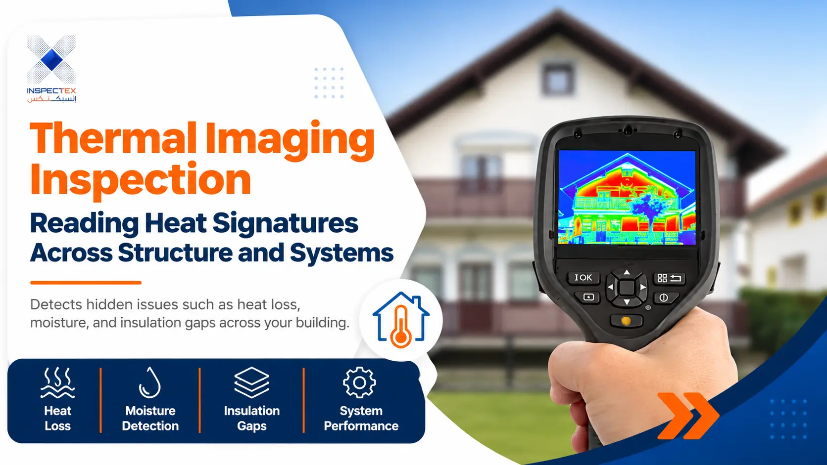
  • Thermal Imaging Inspection: Reading Heat Patterns Across Buildings and Systems

    Thermal Imaging Inspection: Reading Heat Patterns Across Buildings and Systems

    A perfectly painted wall can hide an unusual temperature pattern. An electrical panel may contain an unusually hot connection. Neither clue tells the whole story. The value of thermal imaging inspection comes from understanding what the image shows, what affects it, and which questions still need answers. This guide explains how heat patterns can help owners understand buildings without treating every bright color as a fault.

    Inspectex shares this knowledge to encourage clearer, evidence-based property decisions.

    How Thermal Images Work: Emissivity, Delta T, and Context

    A thermal camera measures infrared radiation from surfaces and converts it into an image of apparent temperature. Colors represent temperature ranges, not direct pictures of damage.

    Emissivity describes how well a surface emits radiation. Shiny metal may reflect nearby heat, while painted surfaces behave differently. Materials, reflections, distance, and viewing angle affect readings.

    Delta T means temperature difference. Comparing similar surfaces or components is often more informative than judging a single temperature. A warm connection can be normal under load, and a cold wall patch can have several explanations.

    There is no universal temperature threshold proving a building fault. Reliable conclusions depend on the system, operating conditions, and supporting evidence.

    Building Thermographic Surveys: Where Patterns Matter

    A thermographic survey commissioned by building owners may reveal insulation gaps, moisture-related differences, and unexpected air movement. The scope should match the property and the question being investigated.

    Insulation Continuity, Thermal Bridges, and Air Leakage

    Missing or poorly fitted insulation may create uneven wall or ceiling temperatures. Thermal bridges, where heat moves more easily through framing or connections, can produce repeating patterns.

    Sunlight, shadows, and construction materials can cause similar differences. Air leakage also depends on pressure and wind, so other checks may be necessary.

    A property condition assessment places these observations alongside the broader building condition. An image cannot calculate insulation performance.

    Moisture Ingress and Concealed Water Damage

    Damp materials may heat and cool differently from dry ones. Evaporation can also cool a surface, creating an unusual image before stains appear.

    However, thermal imaging inspection does not directly measure moisture or see through walls. A cold patch might result from air conditioning or missing insulation.

    Water leak detection therefore needs supporting evidence, such as independent moisture checks and plumbing assessment. A thermal pattern can guide the investigation without proving where water entered.

    Flat Roofs and Facade Assessment

    Wet roof insulation may retain heat differently. ASTM C1153-23 addresses nighttime infrared surveys for particular roof constructions.

    Results depend on the roof layers, weather, and safe access. The image does not establish the leak’s entry point. Facades require equal caution: sunlight, reflections, and mixed materials can imitate defects.

    Thermal Surveys of Operating Electrical Systems

    Electrical thermography helps identify unusual heating patterns in accessible equipment under representative loads. Interpretation must account for normal differences between components.

    Possible Loose Connections, Uneven Loads, and Overloads

    A deteriorated connection may become unusually hot because resistance increases. Overloading and uneven phase loads can also affect temperature.

    During thermal imaging inspection, a hot spot should be compared with similar components and actual current conditions. Lightly loaded circuits may hide problems; heavily loaded circuits naturally produce more heat.

    Electrical problems in the house include risks that infrared images cannot establish, including earthing faults and insulation damage. Separate electrical testing remains essential.

    Switchgear, Distribution Boards, and Backup Power

    Distribution boards and standby systems may show useful thermal differences when operating normally. Equipment that is switched off often provides limited evidence.

    Live electrical equipment can be dangerous. Only appropriately qualified electrical personnel should manage access and follow safe procedures. A standard infrared image cannot reveal every component behind an opaque protective cover. Inaccessible areas must be recorded.

    Mechanical Thermography for HVAC and Rotating Equipment

    Motors, bearings, pumps, and cooling equipment generate heat in normal operation. Unusual differences may indicate friction, restricted flow, insulation problems, or changing operating conditions.

    Comparisons work best between similar components or repeated observations under comparable loads. Speed, ventilation, ambient temperature, and equipment duty all matter.

    Thermal imaging inspection can help prioritize further mechanical evaluation, but it cannot confirm bearing wear, refrigerant condition, or efficiency from an image alone. Other measurements are needed before repairs or replacements are recommended.

    Survey Conditions That Shape Reliable Results

    The same surface may look different throughout the day. Thermal imaging inspection records should note weather, temperature differences, equipment loads, and access limits.

    Load, Temperature Difference, and Weather

    Building surveys generally benefit from a sustained indoor-outdoor temperature difference. No single figure works for every construction type.

    Sunlight, wind, rain, and recent heating or cooling can distort patterns. Some roof surveys require suitable nighttime conditions. A thermographic survey commissioned by building managers should explain the chosen timing.

    Electrical and mechanical equipment should operate under meaningful loads, with those conditions documented.

    Internal Versus External Scanning

    Interior images can reveal patterns near ceiling joints and wall edges. Exterior views may show wider facade differences but are more exposed to solar heating and reflections.

    An infrared building inspection may need both viewpoints, depending on safe access and construction. Consistent temperature scales help prevent misleading image comparisons.

    Professional Thermography Versus a Phone Attachment

    A phone-connected thermal accessory can produce an interesting image. Reliable interpretation requires suitable methods, relevant experience, and clear records.

    Qualifications and Reporting Standards

    ISO 6781-1:2023 describes building thermography procedures. ISO 6781-3:2015, confirmed current in 2026, addresses qualifications for operators, analysts, and report writers. ISO 18436-7:2014 covers personnel qualification for machinery thermography.

    Training should match the application. Experience with building envelopes does not automatically establish competence in energized electrical systems.

    Why One Thermal Image Cannot Prove a Fault

    A cold ceiling patch might indicate moisture, air movement, missing insulation, or a nearby cooling outlet. Likewise, a hot electrical connection requires load information and further checks.

    A credible report separates what was observed from what is suspected and what has been confirmed. It also identifies inaccessible surfaces and uncertainty rather than promising that every hidden problem was detected.

    What a Useful Report Should Tell the Owner

    Images become valuable when they support decisions. A good report identifies the inspected area, operating conditions, evidence, limitations, and recommended next steps.

    Severity, Repair Priority, and Cost Exposure

    Findings should include locations, ordinary photographs where useful, thermal images, and relevant measurements. Priority should reflect verified risk, not dramatic colors.

    A suspected electrical hazard may require urgent qualified attention, while a possible insulation gap could enter planned maintenance. An inspection report should distinguish immediate concerns from further testing and routine monitoring. Reliable repair budgets need a defined scope.

    Baseline Images for Future Monitoring

    Dated images with recorded load, viewing position, and temperature settings provide a useful baseline. Future reviews can identify comparable changes.

    Different color scales can make unchanged equipment look different. Records must therefore preserve the context, not just the picture.

    Frequently Asked Questions About Thermal Imaging

    What Is a Thermal Imaging Survey?

    It is a systematic review of surface temperature patterns. It highlights unusual areas that may require further investigation.

    What Can an Infrared Building Inspection Detect?

    It may reveal suspected insulation gaps, thermal bridges, air leakage patterns, and moisture-related differences. Confirmation often requires other methods.

    What Conditions Are Required for a Thermographic Survey?

    Suitable temperature differences, stable conditions, safe access, and appropriate operating loads where relevant. Weather and recent sun exposure can change results.

    How Often Should Electrical Thermography Be Carried Out?

    There is no universal interval. Frequency depends on risk, equipment importance, maintenance history, operating conditions, and applicable requirements.

    Conclusion: Better Questions Lead to Better Decisions

    A heat pattern is most valuable when it prompts the right investigation. Understanding thermal imaging inspection helps owners avoid rushed conclusions, focus resources, and request clear evidence before accepting repairs.

    Through educational content, Inspectex aims to make these decisions more informed and responsible.

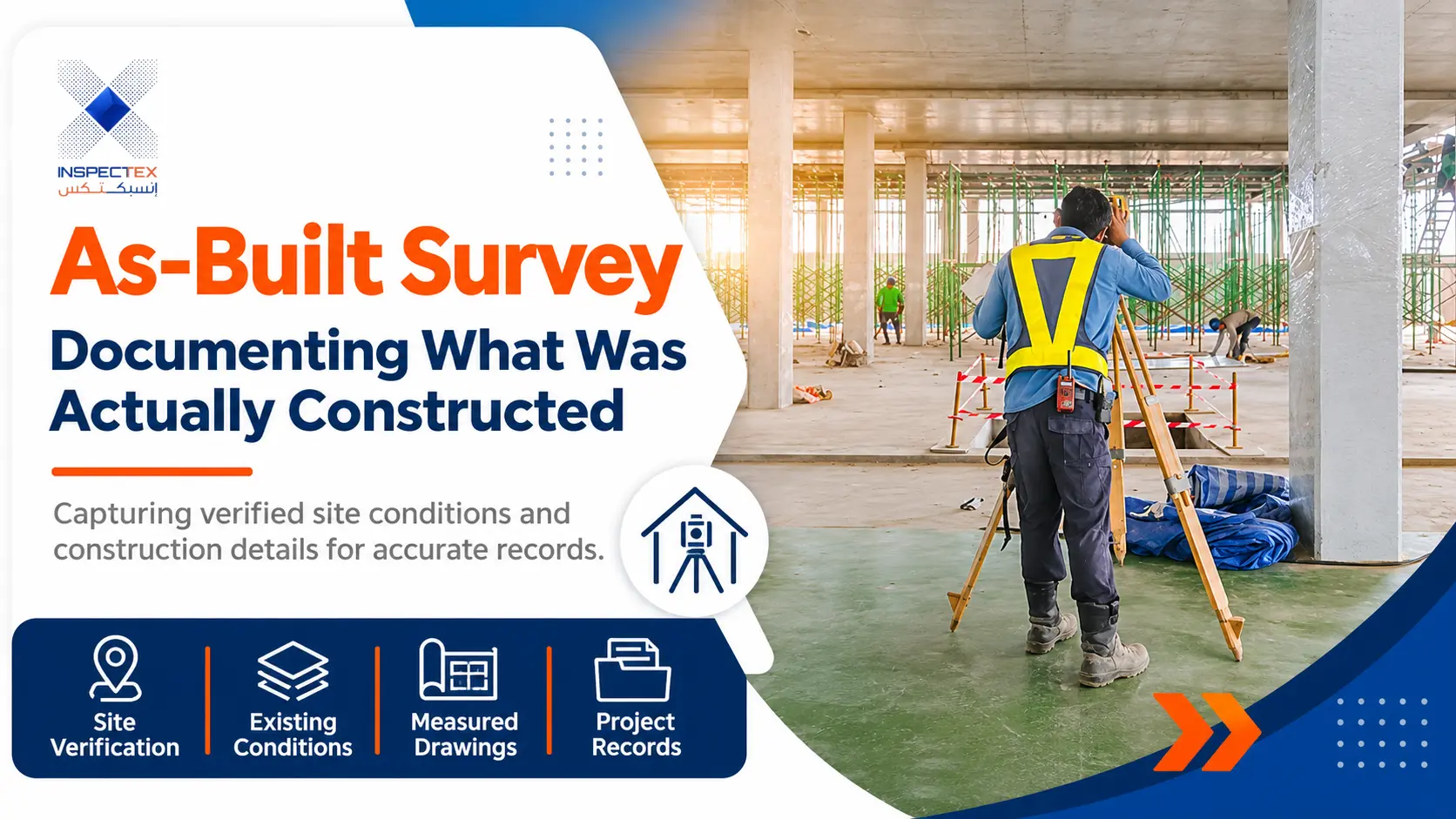
  • As-Built Surveys: Documenting What Was Actually Constructed

    As-Built Surveys: Documenting What Was Actually Constructed

    A pipe changes direction during construction. The ceiling closes, the team moves on, and the original plan remains untouched. Years later, someone looking for that pipe may trust a drawing that never captured the change. An as-built survey helps close this gap between planned and completed work. Understanding that difference can prevent costly mistakes for owners, contractors and future maintenance teams, which is why this educational guide matters to Inspectex.

    As-Built, Record and Measured Building Surveys: Where the Terms Diverge

    Similar names often hide different levels of certainty. An as-built survey uses site measurements to capture the existing location, dimensions and arrangement of a completed asset, within an agreed scope and accuracy.

    Contractor-marked as-built records usually track construction changes. Record drawings may then be prepared by a designer from those updates, without independently measuring every element. A measured building survey focuses on the physical geometry of an existing building, including rooms, elevations and levels. Clients should ask who checked the information, when it was collected and what remained inaccessible.

    What Should Be Included in As-Built Drawings?

    A useful record answers practical questions before anyone opens a wall, replaces equipment or changes a space. The content of an as-built survey should therefore follow the building’s intended future use.

    Structural Grid, Slab Levels and Building Shape

    Show column positions, grid references, floor and roof levels, wall outlines, openings and relevant dimensions. Separate measured features from details taken only from historical plans. Where structural components are concealed, mark their location or dimensions as unverified instead of guessing.

    MEP Routes, Risers, Equipment and Capacities

    Record accessible electrical distribution, plumbing routes, drainage connections, ventilation equipment, risers and major service access points. Include equipment identifiers and documented capacities where reliable schedules or labels exist. A visible route cannot prove where a hidden pipe continues behind a finished wall.

    Changes From Approved Designs

    Compare final layouts with approved plans, documented instructions and authorized variations. Describe relocated openings, redirected services and equipment substitutions using clear references. Records gathered during construction inspections can help trace changes made before walls and ceilings were closed.

    Dates, Revision History and Survey References

    Every sheet should identify its project, issue date, revision, author and status. State the measurement method, agreed accuracy, coordinate system or local reference points, where applicable. Give photographs and digital files names that connect them to the correct drawing revision. Keep original source evidence available so later users can distinguish measured facts from information supplied by contractors.

    When Accurate Construction Records Matter Most

    Incomplete records become especially expensive when responsibility changes hands or a building needs alteration.

    Handover, Operating Manuals and Maintenance

    During pre-handover inspection, teams may identify visible defects, while construction records show where components were installed. These serve different purposes. Facility managers also need operating manuals, warranties, equipment schedules and accessible service locations. Give them a consistent, searchable package rather than unrelated files. Include a handover index explaining which documents are final, which are historical and where equipment maintenance information can be found.

    Property Sales, Due Diligence and Lenders

    Buyers can compare recorded areas, major alterations and equipment layouts with the actual property. A property condition assessment evaluates the asset’s condition, while construction records describe its layout and installed systems. Lenders or buyers may request both, depending on their agreement and risk review. Neither document guarantees an accurate valuation. Buyers should also check whether alterations were approved and whether the supplied records describe the whole property or only selected areas.

    Permit Closure and Authority Requirements

    A project may require evidence of completion and compliance, but submission rules depend on the applicable authority and project. Do not assume every approval requires a full survey package. Confirm the exact deliverables with the responsible municipality, approved engineering office and project contract before submission.

    Saudi Arabia: Documenting Completed Buildings Correctly

    Local compliance deserves its own check. An as-built survey may support project records, but its scope must be agreed separately from regulatory submissions.

    Saudi Building Code and Submission Formats

    As of October 2026, the Saudi Building Code’s 2024 edition applies to new projects whose building permits were issued from June 30, 2025. The Balady occupancy-certificate process involves the relevant engineering office and municipal approval. This does not establish a universal obligation to upload every drawing in one specific format. Confirm whether the client or authority needs PDF sheets, editable CAD files, a digital model or supporting evidence.

    One Controlled Record Across Contractors

    A request labelled “as-built documentation Saudi Arabia” should name the project scope and handover standard. Assign each contractor responsibility for recording changes in its own work. One coordinator should resolve overlapping references, check file versions and identify missing evidence before compiling the final package. Any unresolved differences should be listed openly rather than silently copied into a clean-looking drawing. That prevents conflicting ceiling, structural and service layouts.

    How Reliable Building Surveys Are Produced

    Measurement starts with a clear purpose, not the choice of technology. A modern as-built survey should specify accuracy, accessible areas and the resulting deliverables before fieldwork begins.

    Laser Scanning, Photogrammetry and Manual Checks

    Laser scanning can capture visible surfaces as a three-dimensional point cloud. Photogrammetry uses overlapping images to reconstruct geometry, while direct measurements help verify critical dimensions and areas with limited visibility. A measured building survey may combine these methods. The final model still needs checking, especially around reflective surfaces, hidden spaces and complex plant rooms.

    Non-Destructive Methods for Concealed Elements

    Some methods can help locate embedded reinforcement or concealed features without opening the structure. Their results depend on materials, depth, site conditions and interpretation. They do not prove the exact position or condition of every hidden service. Record what was detected, the method used and uncertainty; use earlier construction photographs or verified installation records where available.

    What Inaccurate Records Can Cost

    One drawing error can spread through a renovation budget, maintenance plan or transaction.

    Rework, Accidental Damage and Disputes

    Incorrect service locations can cause avoidable drilling damage, delays and repeated work. Disagreement over an undocumented variation can also complicate responsibility for changes. A suitable risk assessment should account for uncertain records before invasive work begins. An as-built survey reduces uncertainty only within the areas actually measured or verified.

    Valuation and Insurance Questions

    Missing records can make it harder to establish the extent of alterations, plan repairs or explain building systems to prospective purchasers and insurers. Effects on valuation or coverage depend on the case and the relevant policy or agreement. Treat complete records as evidence, not a promise of approval.

    Frequently Asked Questions About As-Built Surveys

    What Is an As-Built Survey?

    It documents existing building geometry and installed features using measurements and other verified evidence. Its reliability depends on scope, access, survey accuracy and clearly stated limitations.

    What Should Be Included in As-Built Drawings?

    Include relevant dimensions, structural references, accessible MEP layouts, approved changes, equipment information, issue dates and revision details. Identify information that could not be independently verified.

    What Is As-Built Documentation in Construction?

    It is the collection of updated plans, records, photographs, equipment details and change information used to explain what was actually installed. Required contents depend on the contract and project.

    Who Is Responsible for Producing the Final Records?

    Responsibility follows the contract. Contractors commonly record installation changes; designers or surveyors may compile or verify specified outputs. Confirm ownership, review duties and sign-off requirements in writing.

    Conclusion: Keep the Building’s History Usable

    When records reflect reality, future teams can plan with fewer unknowns and avoid repeating old mistakes. Clear scope, traceable revisions and honest limits make every document more useful over time. Inspectex shares this explanation to support informed building decisions and encourage owners to keep reliable records before they need them.

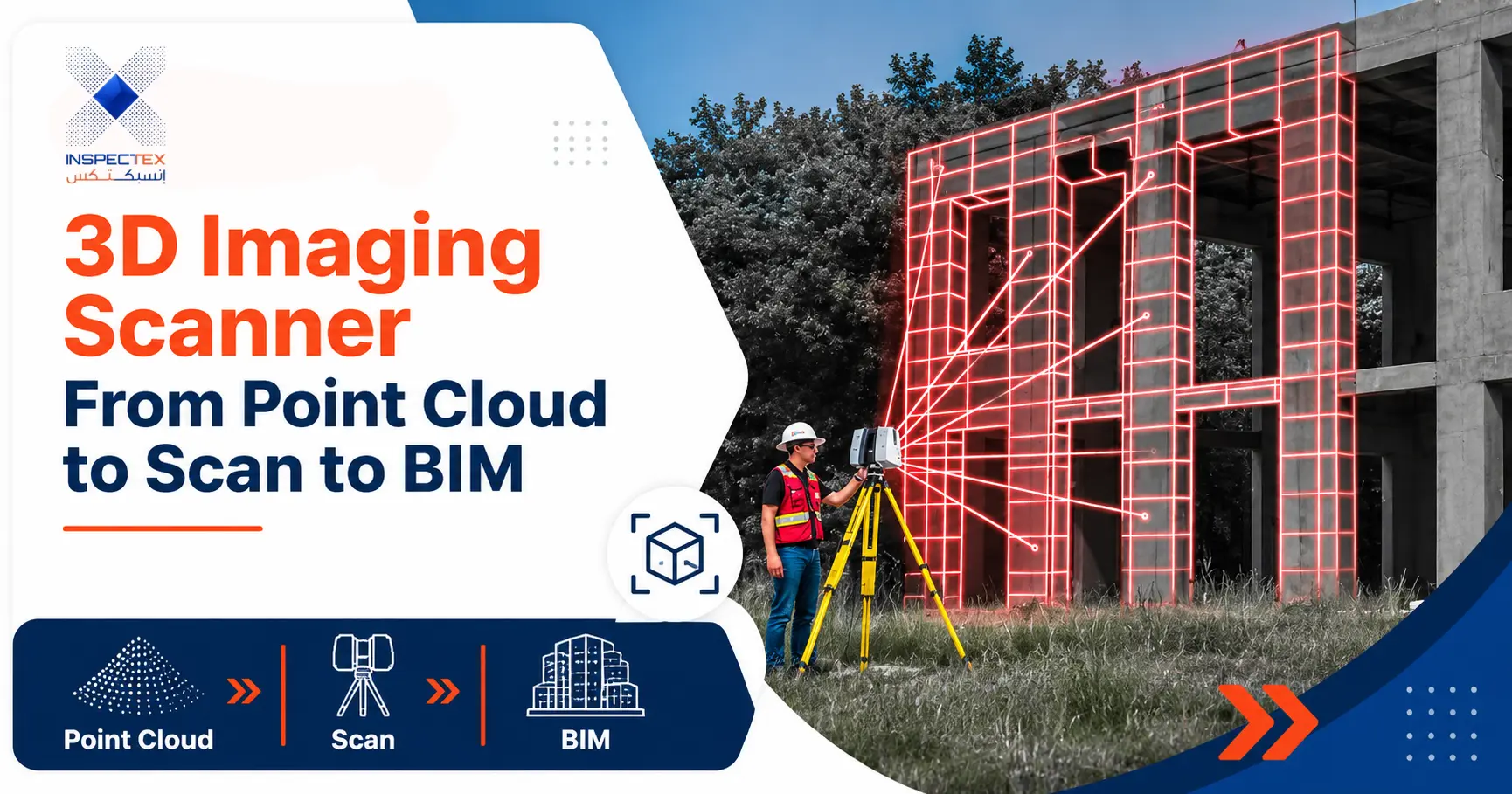
  • 3D imaging scanner in Building Surveys: From Point Clouds to BIM

    3D imaging scanner in Building Surveys: From Point Clouds to BIM

    A new partition reaches an old corridor, and suddenly the drawing no longer fits. The ceiling is lower than expected, the wall bends slightly, and a service pipe takes up valuable space. A 3d imaging scanner captures visible surroundings as measurable digital evidence, helping teams plan with fewer assumptions. To make these decisions easier to understand, Inspectex has prepared this practical guide.

    What a 3D Laser Scanner Captures More Efficiently Than Manual Measurements

    One measured room can contain far more useful detail than a few marked dimensions. The instrument records the positions of many visible surface points, making it easier to understand irregular spaces and compare existing conditions with proposed designs.

    Dense Geometry, Shared Coordinates and Measured Uncertainty

    During 3d laser scanning, the instrument measures distances and directions to surfaces. Software converts these observations into a three-dimensional collection of points. With suitable equipment and conditions, scans can contain millions of points, revealing wall profiles, ceiling levels and exposed pipe routes.

    A tape captures selected lengths; a traditional total station measures chosen positions very precisely. Both remain valuable for control and checks. Scanning adds dense surface coverage, but shadows, glass and hidden spaces can leave gaps. A building inspection addresses conditions and defects, which geometry alone cannot establish.

    Tripod, Mobile and Handheld Scanning Compared

    Tripod-based systems generally suit detailed, controlled capture. Mobile systems cover routes efficiently while moving, although drift and positioning conditions require attention. Handheld systems offer access in tight spaces; some are mobile systems themselves. Selection depends on access, required accuracy and the intended output.

    The Point Cloud Survey Workflow, From Site to Delivery

    Reliable digital drawings start before the first measurement. A 3d imaging scanner needs a capture plan covering rooms, access restrictions, reference points and places where equipment might block the view.

    Targets, Registration and Survey Control

    Survey teams place targets where useful and establish reference coordinates when the project requires them. Overlapping scans are aligned through targets, matching surfaces or both. Independent control checks help reveal registration errors rather than allowing them to spread across the building.

    Cleaning, Decimation and Coordinate Alignment

    Processing removes stray points, checks alignment and reduces unnecessary data without erasing important edges. Teams document any gaps and preserve an original dataset. The final cloud should use agreed coordinates and units so it lines up with architectural and engineering files. Quality review should include checks at doors, stairs and narrow passages, where small missing areas can become important during design.

    File Formats Consultants Can Open

    E57 is a standard exchange format for three-dimensional imaging data. LAS and LAZ are other common point-cloud formats, while XYZ can be useful for straightforward coordinate exports. Native project files may also be needed. Confirm software compatibility, units, coordinate reference and whether photographs or sections are included. A scan dataset is different from an inspection report that explains a building’s physical condition.

    Scan to BIM: Turning Captured Reality Into a Usable Model

    A cloud tells you where visible surfaces were recorded; a model gives those surfaces organized building meaning. The scan to BIM workflow turns selected observations into digital elements such as walls, floors and exposed services. A 3d imaging scanner supplies measurements, but people still interpret them.

    Levels of Development and Their Uses

    Level of Development, or LOD, describes how reliably model elements are defined for a stated purpose. A lower level can support broad planning; more developed elements may support coordination or detailed work. LOD does not automatically certify dimensional accuracy. Agree which elements require modeling and which can remain as cloud data.

    Agreeing Tolerances Before Capture

    Set acceptable differences between measured surfaces and modeled elements before work starts. Specify challenging areas, control requirements and how results will be checked. A neat-looking model can still contain assumptions, particularly where walls conceal pipes or structural details.

    Where Measured Surveys Deliver the Greatest Value

    The strongest results come when the recorded geometry answers a specific project question. A 3D building survey can reduce uncertainty, but its value depends on what the client intends to design, verify or maintain.

    Refurbishment and Fit-Out in Occupied Buildings

    Existing offices and shops often have incomplete drawings or modifications made over time. Accurate visible dimensions help designers plan partitions, equipment and access routes. For a wider view of an asset, commercial property inspection can address physical condition separately from spatial measurement.

    Clash Checks Against Existing MEP Routes

    Visible ducts, pipes and cable trays can be compared with a proposed model to identify potential space conflicts. Concealed routes cannot be confirmed from surface scanning alone. Other evidence or targeted testing may be necessary before construction.

    Heritage and Irregular Geometry

    Old buildings may contain leaning walls, curved surfaces and unusual details that conventional drawings simplify. Laser-based capture supports detailed records for repair planning and conservation, provided access and capture quality are suitable.

    Change and Deformation Monitoring

    Repeat scans can highlight possible movement when taken against stable control and comparable conditions. Differences smaller than the survey’s demonstrated uncertainty should not be treated as proven movement. Results may inform a wider property condition assessment, but interpretation requires relevant engineering judgment.

    How to Question an Accuracy Claim

    A quoted number is useful only when you know what it describes. When a 3d imaging scanner is advertised as accurate to a few millimetres, ask whether that figure refers to instrument performance, registration, relative dimensions or absolute coordinates.

    Request test results at representative distances, independent checkpoints, stated confidence or tolerance rules and a record of inaccessible areas. Ask who checked the final deliverable and whether the reported tolerance covers the entire dataset or only selected checkpoints. Point spacing is not the same as accuracy. Shiny surfaces, long distances, movement and poor overlap can affect results. No single accuracy figure fits every building.

    Budgeting a Scan: What Determines Cost and Duration

    The lowest quote may leave out the data you actually need. The cost of a 3d imaging scanner survey depends on floor area, number of rooms, access windows, site complexity, required detail and output formats.

    Time also includes site preparation, capture, registration, checking and possibly BIM modeling. An occupied property may need several visits. A 3D building survey producing a basic cloud is not priced or scheduled like one requiring detailed modeled services. Ask for separate allowances for fieldwork, processing, modeling and revisions instead of assuming a universal price or duration.

    Frequently Asked Questions About 3D Scanning Surveys

    What Is a Point Cloud Survey?

    It records many measured three-dimensional points representing visible surfaces. The resulting dataset supports dimensions, sections, comparisons and modeling, subject to the survey’s accuracy and coverage.

    How Accurate Is 3D Laser Scanning?

    Accuracy varies by instrument, method, distance, control and environment. Some controlled surveys can achieve millimetre-level results, but that performance must be verified for the actual project.

    How Does a Scan Become a BIM Model?

    Specialists align the cloud, identify relevant building elements and create model objects from the measured evidence. They document assumptions and check the output against agreed tolerances.

    How Long Does It Take to Scan a Building?

    There is no fixed duration. Size, room access, clutter, scanning method and deliverable requirements affect both fieldwork and processing time.

    Conclusion

    Good building decisions start with knowing which measurements are reliable and which questions remain unanswered. Used with a clear brief, a 3d imaging scanner can give project teams a stronger picture of existing spaces. Inspectex shares this guidance to encourage informed planning and thoughtful use of digital survey data.

  • Ground Penetrating Radar: What a GPR Survey Reveals Before You Break Ground

    Ground Penetrating Radar: What a GPR Survey Reveals Before You Break Ground

    A drill reaches the slab. A trench line is marked. The drawings look complete, but one unanswered question remains: what is hidden beneath the surface? An unexpected cable, pipe, or reinforcement bar can turn a routine job into a serious setback. Ground Penetrating Radar helps project teams investigate those unknowns before work begins. It offers useful clues without opening the ground or damaging concrete, provided the results are interpreted carefully. Inspectex prepared this guide to make the technology, its benefits, and its limitations easier to understand.

    How GPR Works and How It Differs From Other Methods

    Every radar scan starts with a simple idea: send a brief electromagnetic pulse into a material and measure the echoes returning from changes within it. Software turns those reflections into profiles that trained specialists interpret. Ground penetrating radar shows contrasts, not labelled pictures of pipes or cables. A wider building inspection may consider many building systems, while radar answers a specific question about concealed features.

    Antenna Frequency, Depth, and Detail

    Higher-frequency antennas can reveal smaller, shallow objects but generally reach less deeply. Lower frequencies may investigate deeper layers while showing less detail. The best setting depends on the target size, expected depth, and material. No frequency guarantees a fixed detection range.

    When Radar Helps Beyond Electromagnetic Locating

    Electromagnetic locators work particularly well for tracing suitable conductive utilities. Radar can also reveal some nonmetallic pipes, disturbed ground, and buried boundaries. However, an electromagnetic locator may trace a known conductive line more clearly. Using both methods can improve coverage when site conditions permit.

    What Can Ground Penetrating Radar Detect?

    A strong reflection is a clue, not an automatic identification. Object size, depth, material, and surrounding conditions all affect whether a target appears clearly.

    Reinforcement, Post-Tension Cables, and Conduits

    Concrete scans can map many reinforcing bars, suggest their spacing, and estimate cover depth. They may also indicate post-tension tendons and embedded conduits. Similar targets can produce similar patterns, so drawings and specialist judgment are important. Cutting near a suspected tendon requires additional care.

    Buried Utilities, Voids, and Backfill Changes

    Below ground, radar may indicate metallic or plastic pipes, underground chambers, voids, or changes in trench backfill. A weak or missing reflection does not prove an area is clear. Small plastic services and objects shielded by metal are especially difficult to detect.

    Slab Thickness, Suspected Delamination, and Moisture Changes

    When the underside gives a clear reflection, radar can help estimate slab thickness. Certain signals may suggest voids, separation between layers, or moisture-related changes. These indications need careful checking: radar cannot reliably identify a leak’s source or confirm every delamination by itself.

    GPR Concrete Scanning Before Coring, Cutting, and Anchoring

    Even a small opening can cross hidden reinforcement or services. GPR concrete scanning is most useful when the scanning area extends beyond the planned hole, giving the operator room to trace nearby objects and propose safer positions.

    Reducing Strikes on Services and Reinforcement

    Before drilling, identify the planned location and depth, scan in more than one direction, and mark the detected paths. Treat unclear signals as potential hazards. Structural approval may still be required before altering reinforcement, and no scan can promise a completely hazard-free cutting zone.

    Comparing Detected Reinforcement With Design Drawings

    Mapped bar positions and estimated cover can be compared with available drawings to highlight differences. A structural inspector can use this information when deciding whether more investigation is needed. Radar alone cannot reliably prove steel grade, exact bar diameter, or full compliance with the design.

    Utility Locating Survey on Busy, Active Sites

    Crowded work areas bring multiple networks close together, sometimes with incomplete records. A utility locating survey should start with existing drawings, visible access covers, and discussions with the utility owners. The scanning plan should follow the proposed excavation route, not simply the easiest ground to reach.

    Survey teams can combine radar and electromagnetic locating, trace likely routes, and mark uncertainty. Critical conflicts may require carefully controlled exposure before excavation. Under the ASCE 38-22 approach, surface geophysics can support Quality Level B information; precise Quality Level A confirmation normally requires exposing and measuring the utility.

    Site Conditions That Reduce GPR Accuracy

    Good equipment cannot overcome every ground condition. Understanding what weakens a signal is as important as recognizing a clear target.

    Clay, Water Saturation, and Conductive Soil

    Wet clay and saline ground absorb radar energy quickly, leaving little useful information at depth. Dry, sandy ground is often more favorable. Moisture changes can also alter calculated depths, so local calibration matters more than an advertised maximum range.

    Restricted Access and Crowded Reinforcement

    Walls, parked equipment, uneven surfaces, and narrow gaps can prevent complete coverage. Dense reinforcing steel may mask deeper objects, while nearby metal can create misleading reflections. When ground penetrating radar produces uncertain results, the report should identify the unscanned areas and recommend other ways to check them.

    What a Reliable Radar Report Should Contain

    The finished drawing should help someone make a safe decision, not merely display attractive scan images. A useful GPR survey records what was investigated, what was detected, and what remains uncertain.

    Plans, Depth Estimates, and Confidence Levels

    A clear inspection report should identify survey boundaries, scan direction, detected routes, surface markings, and estimated depths where supported. It should explain the assumed signal velocity, important limitations, and any locations needing confirmation. Confidence labels help readers distinguish strong evidence from tentative interpretation.

    CAD Files and Alignment With Surveyed Point Clouds

    Georeferenced findings can be transferred into CAD drawings for design coordination. Where a separate site survey or laser scan exists, those findings may also be aligned with a point cloud. Radar does not automatically create a complete three-dimensional model of everything below the surface.

    The Cost of Skipping a Survey: Damage and Delay

    A service strike can interrupt operations, expose workers to danger, trigger repairs, and delay a project. Damaging reinforcement or a post-tension tendon can have particularly serious consequences. A focused risk assessment should consider the proposed work, available records, possible hidden hazards, and practical controls.

    Scanning lowers uncertainty but never eliminates responsibility for safe methods. Teams still need permits where required, utility coordination, suitable exclusion zones, and confirmation of high-risk conflicts. The cost of a survey is best judged against those site-specific risks, not a universal savings claim. For complex sites, agree in advance who will review the findings, approve changes to the proposed work area, and record remaining hazards before the first machine or drill is used.

    Frequently Asked Questions About Subsurface Radar

    What Is a Ground Penetrating Radar Survey?

    It is a non-destructive method that sends radar pulses into the ground or concrete and records reflections. Specialists interpret changes in those signals to estimate the position of hidden objects or layers.

    What Is GPR Scanning Used For?

    Common applications include locating buried services, mapping reinforcement, investigating possible voids, and estimating layer thickness. The method helps plan drilling and excavation, but ambiguous results may need confirmation.

    How Deep Can GPR See?

    There is no universal depth. Frequency, target size, soil conductivity, and moisture control penetration. In highly conductive ground, useful readings may be shallow; favorable conditions can allow considerably deeper investigation.

    Does Radar Replace Trial Pits and As-Built Records?

    No. Records provide context, radar offers additional evidence, and carefully planned trial pits can confirm critical utility locations. These methods work best together, particularly where damaging a hidden service would create serious risk.

    Conclusion

    What lies unseen should not become an avoidable surprise on site. Ground penetrating radar can make planning more informed, provided its findings are checked against real conditions and its limits remain visible. Inspectex shares this knowledge to help owners and project teams ask better questions before cutting, drilling, or excavating.